If you’ve ever driven through the Arkansas Delta, you know that the land is famously flat with miles of rich farmland stretching to the horizon. That’s one reason that Crowley’s Ridge feels so surprising.
This unique ridge suddenly rises up 150 to 200 feet above the flat Delta plains.
This area is a geological standout and one of the most interesting landscapes in the state.
Crowley’s Ridge: Arkansas’ Unexpected Landscape in the Delta
We have spent quite a bit of time on Crowley’s Ridge lately while driving the Great River Road and visiting Crowley’s Ridge State Park.
The ridge is so interesting and unexpected that I decided to do a little more research on it!
Here are some of the things that I learned about Crowley’s Ridge.
Unique Geology of Crowley’s Ridge
Crowley’s Ridge stretches roughly 150 miles from southeastern Missouri down to Helena, Arkansas. It is narrow, ranging only from 1 – 12 miles wide.
The ridge is an unusual landform that scientist believe was once an island between the ancient channels of the Mississippi and Ohio rivers.
It became a long and narrow hilly ridge after the rivers changed course many, many years ago.
Over the centuries its height was further built up even further by deposits of windblown glacial dust, called loess.
What is Loess?
Loess is a rare soil that is found on the ridge. It is a fine grained soil that was created as glaciers moved across the continent.
This soil is so fine that it is easily wind blown. The rivers washed this soil away in the lower areas but on Crowley’s Ridge it continued to collect and build up.
It is up to fifty feet deep in some locations!
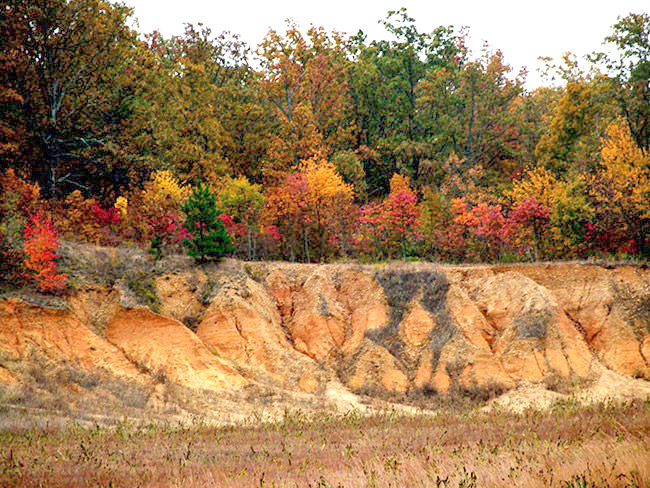
Because Loess is easily eroded the ridge is characterized by steep slopes and deep valleys.
Although the ridge is located in a highly agricultural area you won’t find many row crops here as the easily eroded soil makes the land here more suitable for pastures and forests and orchards.
Unusual plant life
That history of the ridge might explain why it has an unusual mix of plant life compared to the rest of the Arkansas Delta.
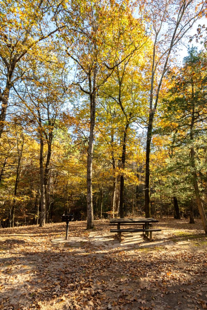
While much of the surrounding area is made up of farmland, Crowley’s Ridge is home to forests with trees such as the American Beech and the Sugar Maple that are typically more common in the Appalachian Mountains.
It is a very different landscape than you typically find in Arkansas.
This brings both vibrant fall foliage, gorgeous spring wildflowers, and makes for a unique and scenic natural environment.
History of the Ridge
The ridge provided a refuge for the frequent flooding of the Mississippi River both for the Native Americans who originally lived in the area as well as the new settlers.
It was named after one of the first white settlers in the area, Benjamin Crowley. His grave is now located in the Crowley’s Ridge State Park.
The ridge was a primary north-south travel, communication, and settlement route. So, of course, towns grew up along it the ridge.
Some of these are Paragould, Helena, Wynne, Forest City, and the largest city in the area, Jonesboro.
Jonesboro is considered to be the hub of Crowley’s Ridge.
Crowley’s Ridge Parkway National Scenic Byway
You can drive along Crowley’s Ridge on the Crowley’s Ridge Parkway which is a National Scenic Byway.
The parkway is not a single road but is a series of connected highways and county roads as well as some city streets.
It was designated as a National Scenic Byway in 1998.
The Crowley’s Ridge Parkway is not part of the Great River Road although the two routes do overlap for a few miles around the Mississippi River State Park and the St. Francis National Forest.
State Parks on Crowley’s Ridge
There are 5 state parks along the ridge!
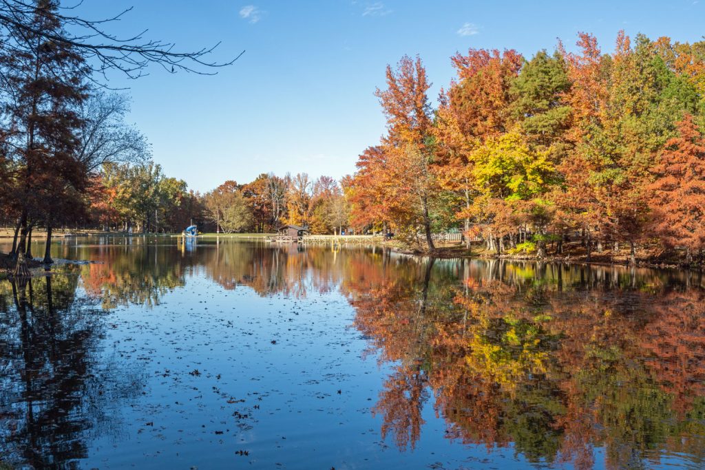
- Crowley’s Ridge State Park is one of the best places to go for camping, hiking, swimming, fishing, and other recreation on the ridge. It is located near Paragould and was built by the CCC in the 1930’s.
- Lake Poinsett State Park is a quiet state park with camping, a day use area with a playground and picnic tables, and good fishing.
- Lake Frierson State Park has a very laidback feeling. There are 7 campsites and a fishing pier.
- Village Creek State Park has 7,000 acres of beautiful forested hills and clear streams. It also features a championship golf course.
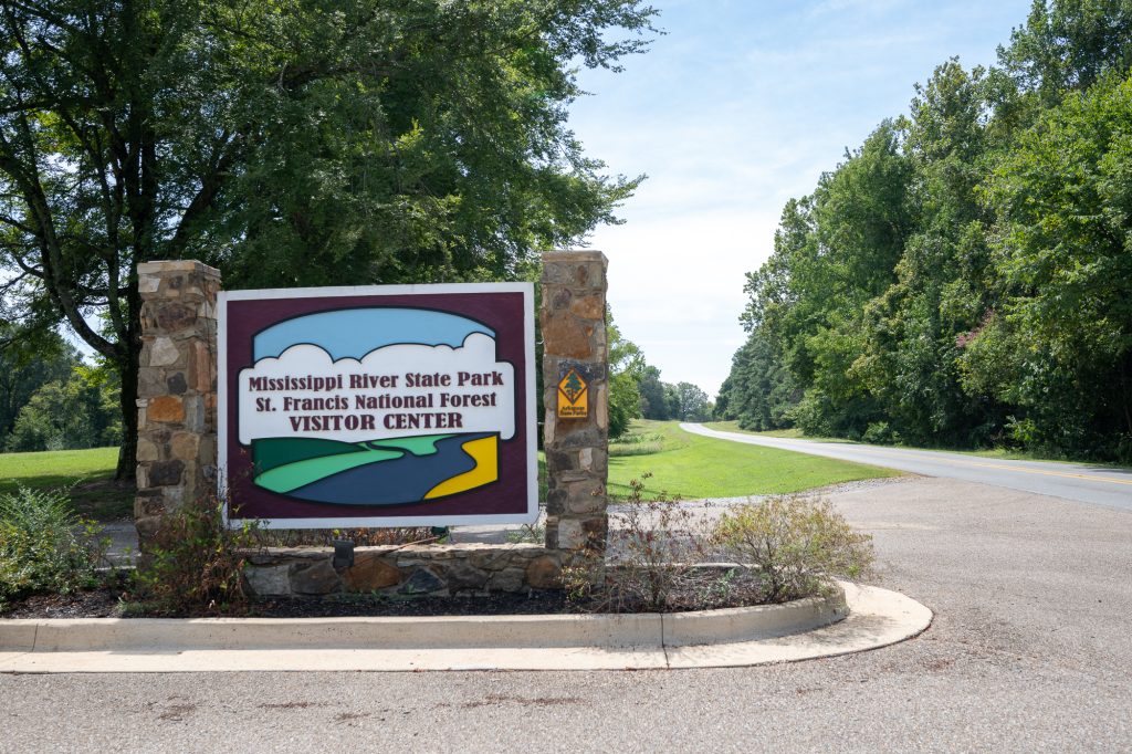
- Mississippi River State Park provides access to the St. Francis National Forest and offers visitors adventures where the Mississippi River, Crowley’s Ridge and the Arkansas Delta meet. This is the point where the Great River Road and the Crowley’s Ridge Parkway overlap for a short part of the drive.
More Places of Note
- The Forrest L. Wood Crowley’s Ridge Nature Center in Jonesboro provides interactive exhibits, a film and accessible trails to learn about the region’s natural history.
- Craighead Forest Park in Jonesboro for great recreational opportunities
- The Hemingway-Pfeiffer Museum and Educational Center to learn a little more about the literary history of the area.
- The Delta Cultural Center and King Biscuit Time Studio highlights the area’s blues music, and agricultural heritage.
- Chalk Bluff Natural area is situated on the northern end of the ridge where the St. Francis River cuts through the ridge. This is a very interesting area where the Loess has been eroded and is exposed giving the appearance of chalk.
Crowley’s Ridge is one of those destinations that surprises you. It is beautiful and peaceful and so unique.
It is said to have once been an island in and many ways it still feels like it is one due to the way it rises like a green line from the flat Delta farmland.
Whether you’re interested in geology, history, small-town charm, or simply wandering through the woods, this ridge offers a refreshing change of pace.
If you’re planning a road trip through eastern Arkansas, definitely make time for this unique area.
Thanks for stopping by!